UN
4 Priest Row
£ 326,000
Description
We don't have a Description for this property.
- Bedrooms
- 3
- Bathrooms
- 0
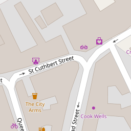

Leaflet © OpenStreetMap contributors
The heatmap indicates the level of crime in the area. The color of the heatmap indicates the crime severity and recency.
Metrics Year-on-Year
- Average area value
- 312,500.00 £Decreased by 19.51 %
- Average area rental value
- 889.00 £/moIncreased by 5.58 %
- Est rental Yield
- 3.41 %Increased by 31.15 %
- Crime Rate
- 31.00 %Unchanged by 0.00 %
from 388,263.00 £
from 842.00 £/mo
from 2.60 %
from 31.00 %
Nearby Schools
| Name | Type | Ofsted | Distance |
|---|---|---|---|
| The Blue School | Academy Converter | Good | 0.60 KM |
| Wells Cathedral School | Other Independent School | 0.83 KM | |
| St Cuthbert'S Cofe Junior School | Voluntary Controlled School | Requires improvement | 1.03 KM |
| St Cuthbert'S Church Of England Academy Infants And Pre-School | Academy Converter | Good | 1.12 KM |
| Stoberry Park School | Community School | Good | 1.18 KM |
Images
Nearby Streets
| Name | Average Price | Average Sqft | Distance |
|---|---|---|---|
| Stuarts Close | £ 0 | 0 | 0.00 KM |
| Huddleston Court | £ 245,000 | 0 | 0.00 KM |
| Melrose Court | £ 0 | 0 | 0.00 KM |
| Kennion Road | £ 239,950 | 0 | 0.00 KM |
| Wookey Hole Road | £ 580,000 | 0 | 0.00 KM |
Nearby Listings
| Address | Price | Type | Score | Distance |
|---|---|---|---|---|
| Union Street, Wells, BA5 | £ 265,000 | BUY | 6 / 10 | 0.09 KM |
| Union Street, Wells | £ 185,000 | BUY | 5 / 10 | 0.10 KM |
| Chamberlain Street, Wells, BA5 | £ 785,000 | BUY | Unknown | 0.10 KM |
| Market Street, Wells, BA5 | £ 325,000 | BUY | 7 / 10 | 0.12 KM |
| Market Street, Wells, Somerset, BA5 | £ 185,000 | BUY | 5 / 10 | 0.13 KM |
Nearby Properties
| Address | Price | Distance |
|---|---|---|
| 16 Priest Row | £ 190,000 | 0.00 KM |
| 22 Priest Row | £ 340,000 | 0.00 KM |
| 5 Priest Row | £ 375,000 | 0.00 KM |
| 4 Priest Row | £ 326,000 | 0.00 KM |
| 14 Priest Row | £ 281,500 | 0.00 KM |